Houston's Freedmen's Town: the bricks and the neighborhood behind them
A 2018 city account describes the return of original paving. Older neighborhood records connect the streets to homes, businesses and named residents.
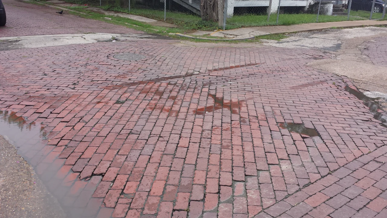

Houston's February 28, 2018, account of a Freedmen's Town street repair began with the original bricks. The city said crews had started reinstalling them at Andrews and Genesee streets after the paving had been removed, cleaned, cataloged and stored. Returning the same material, rather than replacing it with new paving, was part of the preservation work described in the announcement. [1]
The city also gave its account of why the bricks had come out. According to the release, a contractor accidentally disturbed them after exceeding the authorized limits of a drainage project. Workers removed them by hand in November 2016. The release said more than 3,610 bricks had been removed and that an archaeologist would oversee reinstallation and document the work.
That announcement establishes what the city reported at the start of reinstallation, not independent confirmation that the project was completed or evidence of the street's condition today. It concerns one intersection. The accompanying 2014 file photograph shows another Freedmen's Town intersection, identified by its source as Wilson and Andrew Street, not the 2018 work at Andrews and Genesee. [4]
The neighborhood's history reaches much farther back than that repair. Freedmen's Town developed in Houston's Fourth Ward after emancipation. BlackPast's history describes formerly enslaved people arriving from surrounding Texas and Louisiana plantations and building homes, churches and businesses. The National Register nomination places the original settlement south of Buffalo Bayou and describes its expansion south and west over subsequent decades. [2] [3]
The nomination, received by the National Park Service in 1984, documents narrow streets, closely spaced wooden houses, corner businesses and institutions. It traces changes through maps and city directories. These records allow readers to follow particular addresses and buildings, while remembering that the nomination describes the neighborhood as it was documented then, not a current inventory.
One example is the family of the Rev. Jack Yates. The nomination identifies a home built by his son Rutherford beside the family homestead on Andrews Street. Across the street, it identifies the home of minister and entrepreneur Ned P. Pullum. The entries connect particular places to named residents and their work. [2]
The same document records losses. It describes clearance for San Felipe Courts, later known as Allen Parkway Village, and the displacement of Black residents by a public housing project for white residents. It also describes highway construction and downtown expansion consuming parts of the larger community. These historical accounts explain changes in the district without establishing which buildings survive today. [2]
Neither the nomination nor the 2018 announcement should be stretched into proof of the age, maker or symbolic meaning of every individual brick. Each source answers different questions: one documents a neighborhood's buildings and development, while the other records the city's account of a specific public project. The bricks belong within that wider history of residents, homes and institutions.
Before visiting a named street or house from the nomination, compare the historical account with current information and respect homes and ordinary neighborhood activity. At Andrews and Genesee, the city's 2018 account describes a practical part of preservation: keeping track of the paving that had been removed so the original bricks could be put back.
Sources
- City of Houston NewsroomThe bricks were cleaned, cataloged and stored ... removed by hand in November2016 after they were accidentally disturbed by a City contractor who exceeded the authorized limits of a drainage project ... An archeologist will be on site ... final report.
- National Park Service / Texas historical nomination recordSection7 describes original settlement after emancipation, expansion, maps, houses and corner businesses. Pages2 and6 identify Rutherford Yates and Ned P.Pullum houses, San Felipe Courts displacement and later highway/downtown losses.
- BlackPast.orgCommunity located in Fourth Ward ... destination for former enslaved people from surrounding plantations in Texas and Louisiana ... built houses and churches ... businesses.
- Wikimedia CommonsFile-specific own-work declaration, creator, CC BY-SA 3.0 license, date, location description and original checksum.