Beyond downtown, a San Antonio river walk needs a return plan
The Mission Reach connects historic sites along the river, but it is not a loop. Choose a segment and check trail notices before setting out.
A walk between San Antonio's missions needs a return plan as well as a destination. The Hike & Bike Trail along the river is an out-and-back route, not a loop, according to the National Park Service. Choosing one segment can make for a more manageable outing than setting off with all five missions on the list. [1]
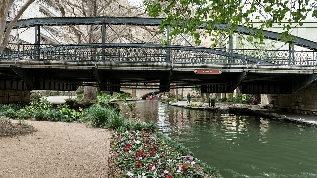
The Mission Reach also looks different from the downtown River Walk. NPS describes an urban ecosystem-restoration area with native grasses and wildflowers. The bridge, flowers and waterside path in the accompanying photograph belong to the downtown stretch, photographed by Carol M. Highsmith in 2014. Farther south, use the Mission Reach map to choose your entrance and route rather than expecting that downtown setting throughout. [2]
The trail connects the Alamo, Mission Concepción, Mission San José, Mission San Juan and Mission Espada. NPS gives roughly 2.5 miles between missions as a broad description. That spacing is useful for understanding the scale of the outing, but it should not replace directions and distances for the particular access point you choose.
The Graf Road trailhead offers a more specific example. NPS places it just west of the Mission San Juan parking lot, with the trail beginning at a bike-share station. Its directions describe meeting the river 0.6 miles south and continuing south to reach Mission Espada at a total distance of 1.4 miles. Those are route directions from that access point, not a promise that a rental bicycle will be available. [3]
Check notices alongside the map. A San Antonio River Authority alert carrying an October 12, 2026 update warns of temporary trail closures near Mission San Juan, Mission Espada and the location it calls Conception Park for stem-density work. The notice asks visitors to respect workers and closures. It gives no reopening date and does not establish that the entire Mission Reach is closed. [4]
The authority was still displaying that notice when checked on November 17. Review its latest alerts and posted signs before setting out. If work blocks a planned connection, be prepared to shorten or change the outing. A published route map cannot confirm that every part of the path is accessible on the day you visit.
Before leaving, locate water, restrooms and access points on the Mission Reach map. NPS recommends carrying water and sunscreen and wearing a helmet when cycling. Its guidance also identifies pedestrian-only connecting pathways, so do not assume every paved approach to a mission is open to bikes. Follow the signs for the path you are using. [1]
Decide where you will start, which directions apply to that entrance and how you will get back before adding another mission. An agreed turnaround point keeps the return journey part of the plan, rather than an extra trip to work out after reaching the destination.
Sources
- National Park ServiceHike and Bike Trail
- Library of CongressBridge above the River Walk, San Antonio, Texas
- National Park ServiceGraf Road Trailhead - San Antonio River Hike & Bike
- San Antonio River AuthorityStem Density Efforts