A West Texas dust wall can arrive before the rain
Thunderstorm outflow can lift a blinding wall of dust ahead of the storm. A documented Lubbock event shows why rain is not the only travel hazard to watch.
On June 5, 2019, a line of thunderstorms pushed a wall of dust across the South Plains. The National Weather Service's Lubbock account records visibility falling to a quarter-mile at the airport and near zero in some places. The rain that followed helped end the thick dust, but drivers had already faced a period of dangerously limited sight. [1]
That sequence explains why a forecast mentioning thunderstorms deserves attention even before rain reaches the windshield. A haboob is a dust storm generated by thunderstorm outflow winds, according to the weather service. Air moving outward from a storm can lift dust into an advancing wall, reducing visibility ahead of the wetter part of the system. [2]
The Lubbock account describes storms forming in eastern New Mexico and the northwest South Plains, then organizing into a broken line moving east. Strong winds pushed ahead of them, raising dust across the central and eastern South Plains and off the Caprock. The office issued Dust Storm Warnings as well as Severe Thunderstorm Warnings. Those alerts described related hazards, rather than two names for the same thing.
For someone driving between towns, the immediate problem is what can still be seen on the road. The weather service warns that dust can arrive suddenly and contribute to chain-reaction collisions. A brief episode can still be serious: the time available to respond may shrink while vehicles ahead become difficult to locate. Waiting to see whether heavy rain develops misses the earlier visibility hazard.
NWS guidance starts with avoidance: do not enter a dust-storm area if you can avoid it. If dense dust is approaching or crossing the road, the agency advises pulling off the pavement as far as possible and stopping. Never stop in a traveled lane. Once safely off the roadway, set the parking brake, turn off the lights and take your foot off the brake pedal so the rear lights are not illuminated. [2]
The lights-off instruction applies to the stopped vehicle off the roadway, not to driving through dust. NWS explains that other drivers have mistaken a parked vehicle's lights for a path to follow, left the road and collided with it. If you cannot pull off, the agency advises keeping lights on, traveling at a speed suited to visibility and looking for a safe place to leave the roadway.
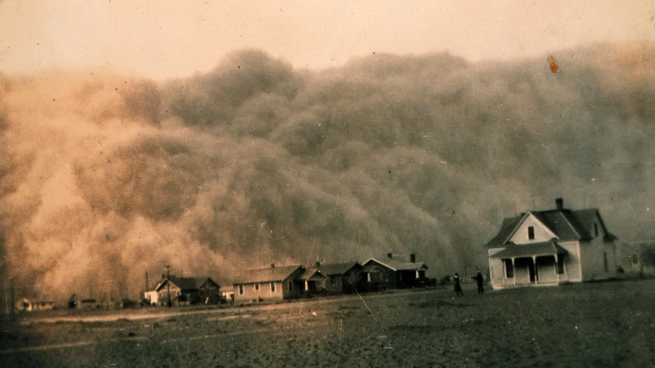
Texas has a much longer photographic record of dust storms. The image accompanying this article was made near Stratford around 1935 by George Marsh of the United States Coast and Geodetic Survey. The U.S. Fish and Wildlife Service identifies the photograph and its approximate date. It is historical, not a picture of the 2019 Lubbock storm or an active warning, and the image alone does not establish what generated that particular dust cloud. [3]
For today's trip, consult the current forecast and alerts from the weather service office covering your route. The historical example explains a mechanism; it does not forecast a dust storm this evening. When an advancing wall is visible, the useful decision is whether you can avoid entering it, not whether rain will soon wash the dust away.
Sources
- National Weather Service, LubbockSevere thunderstorms generate a Haboob - 5 June 2019
- National Weather ServiceDust Storms and Haboobs
- U.S. Fish and Wildlife ServiceDust storm approaching Stratford, Texas